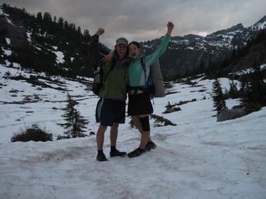
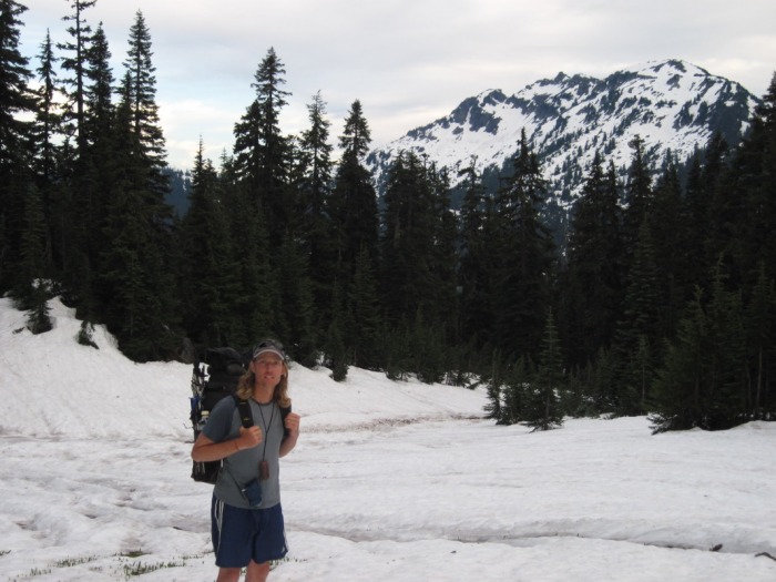
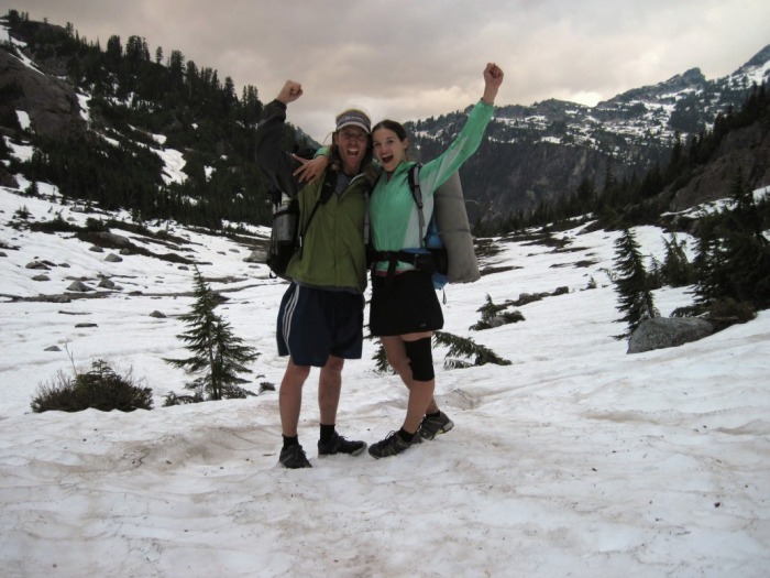
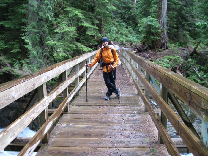
 Feeling victorious! And hucking it huge ;) The 200 mile mark has been passed!
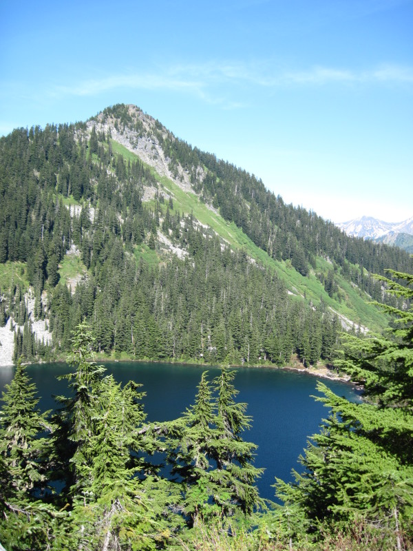
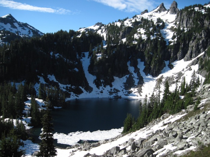
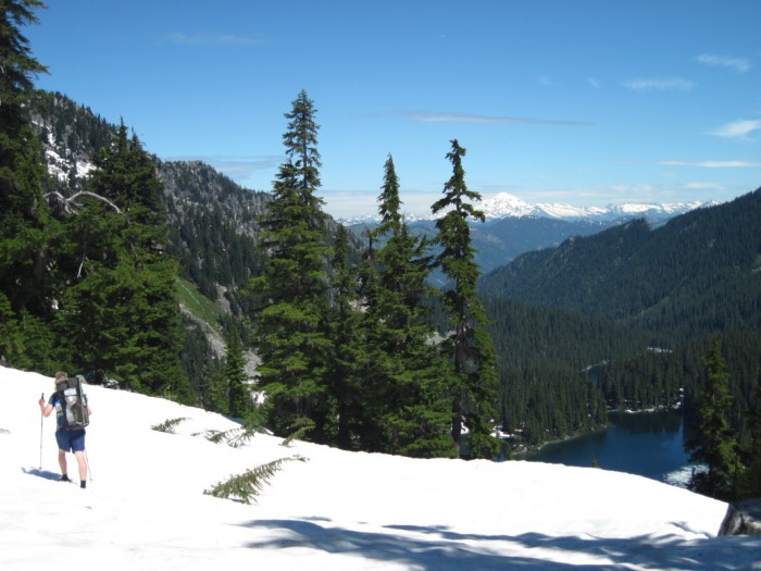
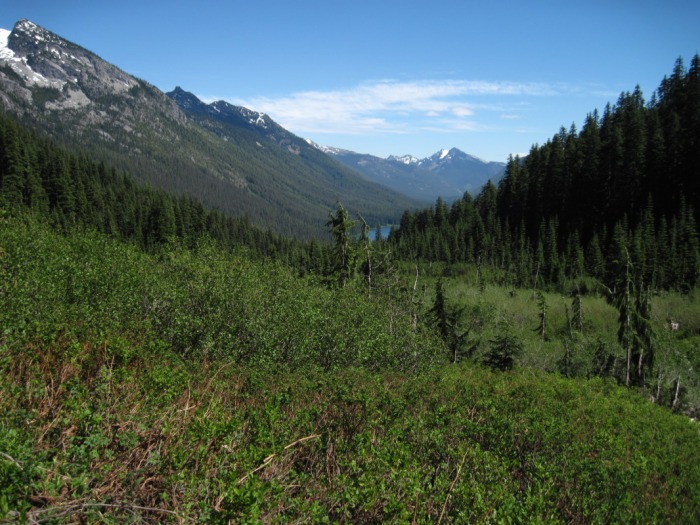
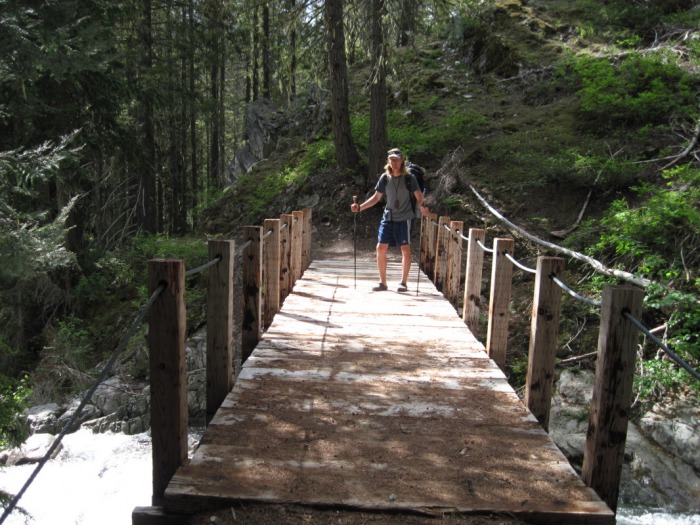
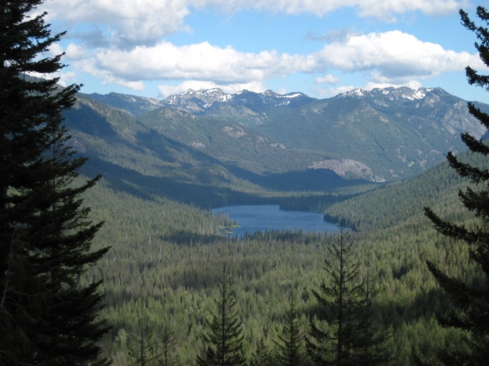
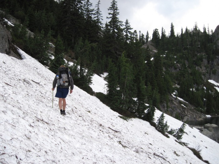
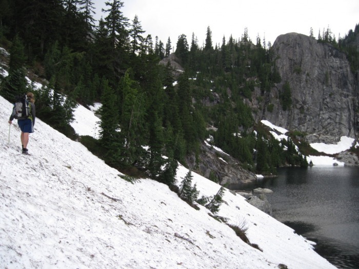
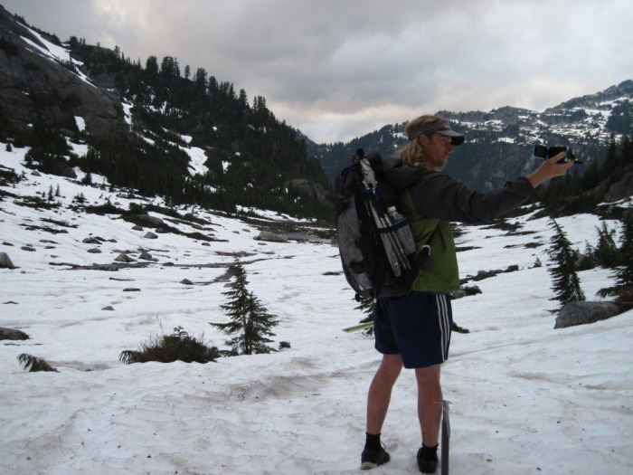
Beautiful weather was such a blessing on this section. The scenery was just spectacular-beautiful valleys, alpine lakes, waterfalls, snow-covered mountains (Glacier Peak!)...Glorious. We still walked over 70 miles (total distance unknown due to detours) and had our fair share of being tired, sore, scared, wet, hot, scraped, jabbed, and frustrated, but it was all worth it! We did it together, and God was faithful to provide all that we needed to complete the journey :)
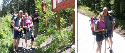
Day One Photo Gallery:
Day Two Photo Gallery: Day Three Photo Gallery: Day Four Photo Gallery: A letter to some new friends,
Beau, Tam, and Sean (I hope I spelled your names right!) it was so fun meeting you guys! To share our tales, laughter and some information with you was a highlight for us! We thought of you so many times, whether it was they're going to hate this! or they'll be glad there's no snow here! We hope you made it out safely and enjoyed your adventure. And I joined the club with the scratched-up legs! Unfortunately. It was awful and brought me to tears! But we made it out Monday, and we're on our way again today. Hope to hear from you guys again! Peace out!
We've had a great visit here in Snoqualmie, and now we're ready to head off again. Curt and Lisa, seriously, so good :) We LOVED seeing you and Kristen! And our dear family took really good care of us, feeding us yummy food and giving us great company! We could stay here much longer but we really gotta get going! Gavin, happy, happy birthday to you dear brother. Sorry we're going to miss celebrating the big 3-0 with you!
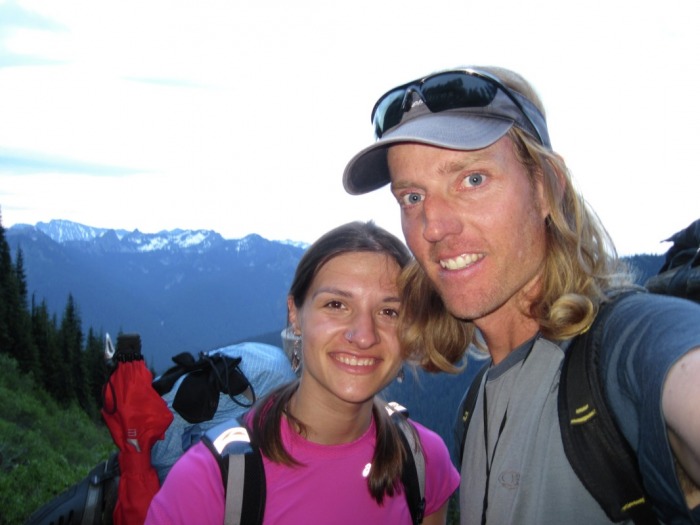
So our next destination is White Pass, approximately five days from here. We're following the footsteps of a few other southbounders-wonder if we'll ever catch up?!
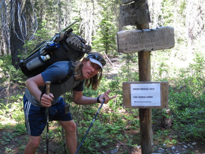
We're on our own from here! No more family visits, so it feels kind of weird. But we're off! Hucking it huge, giving it some heat...all of the above.
 Leg 3 begins! First snow at one-half mile Rich here ...
Boyes are back on the trail! Cindy and Marc took them to Stevens Pass to head Southbound on Friday at 1:00. They hiked part way with them, till they hit first snow. MJ Crandall lives at Stevens, and hiked the first mile with them. Cassandra's knee is almost healed, so she is wearing a knee support. Jason has a swollen ankle, but it is not bothering him.
Now, we wait until they reach Snoqualmie Pass before we hear from them again.
Hopefully, that will be around Thursday, July 15th.
Cindy and I had to take Marc to SeaTac on Saturday morning, so we dropped off their "Bounce Box" with the Neylands. The Neylands will pick them up at Snoqualmie Pass after they arrive, and take them home to resupply. Of course, Neylands are hoping they stay for a couple of days. They miss Jason and Cassandra a lot. We were so glad to meet them. We hit it right off, and had a great visit with Jerry, Marti and Gavin.
♥It would be such a joy for us to receive a note from you while we're out there♥
We think the best way to do that is for you to send your things to Rich and Cindy, and then they'll go ahead and put those into the next boxes that they send out.
The address is:
Jason and Cassandra Boyes
c/o The Cram Family
19210 West Side Dr.
Leavenworth, WA 98826
So we're off again, trekking to Snoqualmie! Your continued prayers mean so much to us...
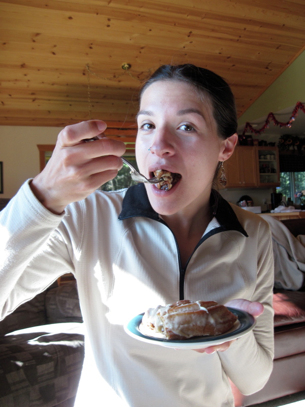
Dear Rich, Cindy, Marc and Dakota, We really can't put into words how thankful we are for all that you've done for us in these last couple of weeks. Our hearts are full to the brim with the love that you've poured out on us! (And our tummies are full of good food, especially ice cream! Thankfully we're getting back on the trail to lose some of the weight!)
In hind-sight, I think that God probably had us right where we were supposed to be-A place where we could be loved on in such a special way. There sure is lots of love to go around here at the Cram Inn!
We leave you with the longing to be back here again at our journey's end, and want you toknow that we love you very much. Marc, we'll miss you but can't wait for snowmobiling season again! Safe travels :)
Sincerely, Cassandra and Jason
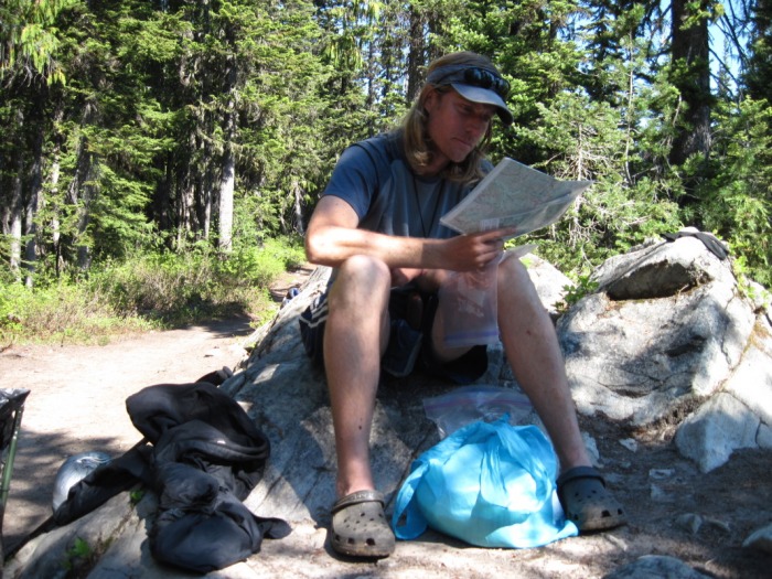
before leaving on this trip, i didn't want to even take a gps, earlier post talked about being more traditional and a map and compass type of guy. oh how things have changed for me. with the conditions that we've been facing, the gps has been a saving grace to us. when you are in the clouds and can't see 30 feet in front of you, how do you figure out where you are on a map?
anyway, i don't like becoming dependent on technology, but the gps has become a necessity for us in the snow and i honestly don't know if we could do it without it. here are a couple of things that we've noticed though when comparing our gps experience to that of others.
when you are in snow and you have 1 mile waypoints on your gps, its makes navigation extremely difficult. the trail can do so much in a mile, even in a half mile.
tracks are the way to go, halfmile (at www.pctmap.net) has made it possible to download all the tracks for the pct onto your compatible gps device, but note that not all gps's can download the tracks. after emailing him a couple of times before the trip, i returned my first gps and got a different one so that i could have the tracks and not just wayponts.
-waypoints show points on the trail every 1/2 mile to mile
-tracks show the actual path travelled
when we are in the snow, i can turn the gps on and it will show me where i am and then it shows a pink line where the pct is and i can see if i am higher or lower compared to the trail.
anyway, if this doesn't make sense and you are considering using a gps, i would definitely look into it because it makes a difference on the trail.
i am now a believer in gps, especially when i lost my guidebook and didn't have maps anymore.
once again, thanks halfmile for making these resources available
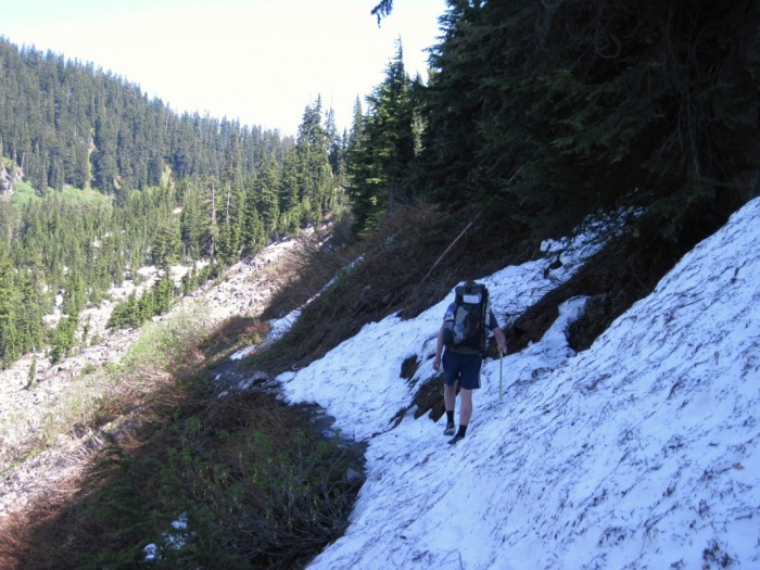
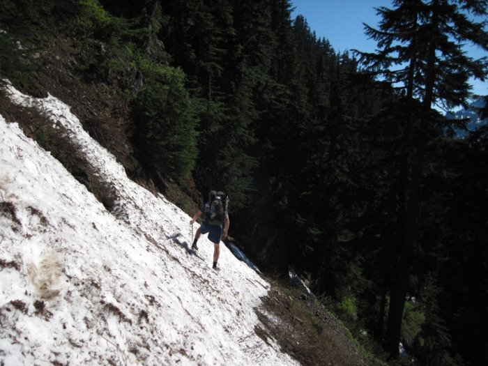
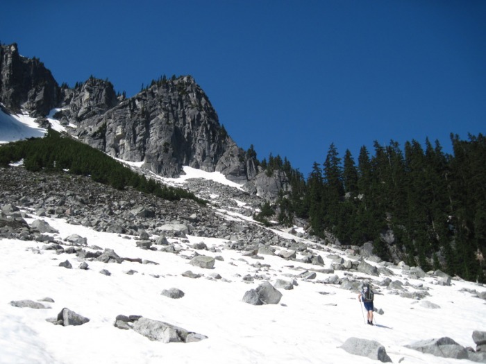
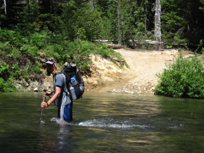
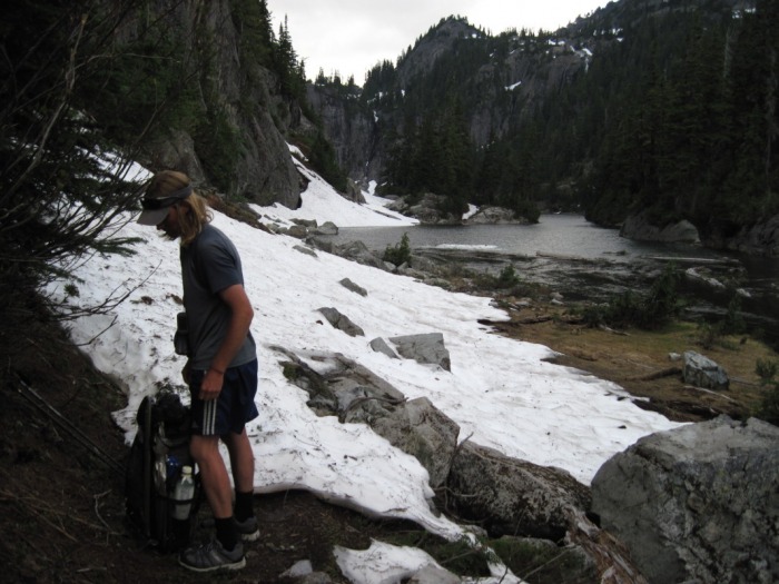
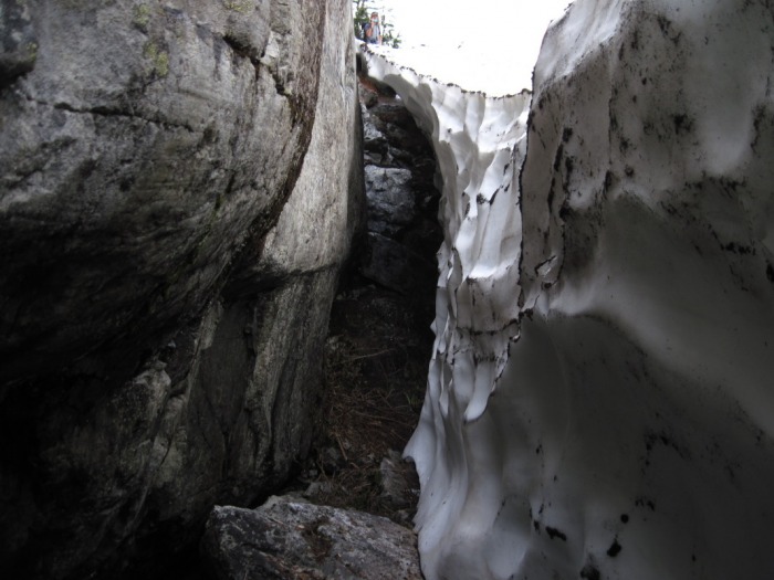
for me, the old pct was a very doable option. river and creek crossing were all possible, down trees had paths around them, it was not nearly as exposed as the section north of rainy pass, so i would recommend taking the old pct. with that, conditions are not the same for everyone, i have found out that a group of southbound left a couple of days before me and came out at milk creek and didn't make it through, so everyone needs to make their own judgement call. be wise, there is still lots of snow above 5000 feet, the weather has been warmer the last couple of days, but that doesn't mean that the trail is bare.
i hope others will get more views of glacier peak than i did.
i also didn't see much in the terms of wildlife, no bear, no elk, no deer, just marmots, pikas, chipmunks and birds, although i was really glad that i didn't see any mosquitos either.
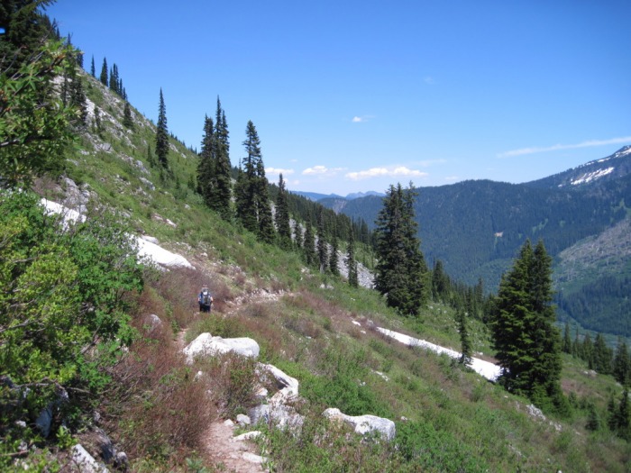
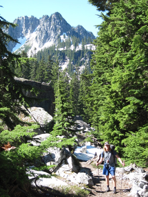
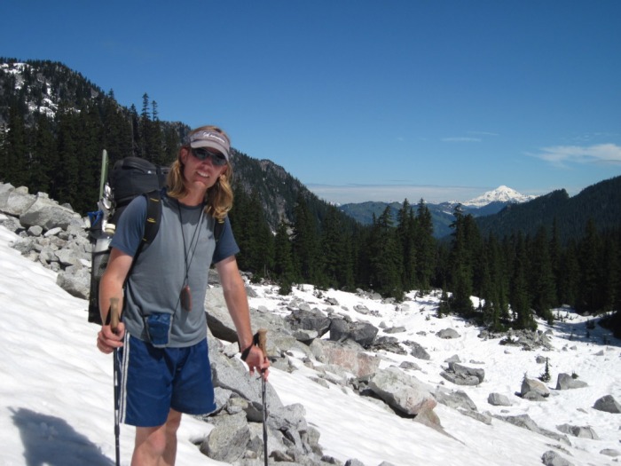
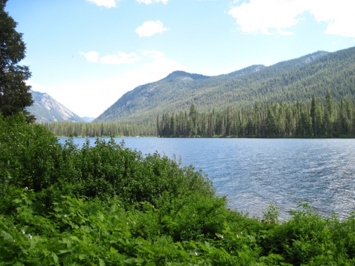
overall its a beautiful section, it was nice to be on actual trail for longer periods of time and i look forward to doing it again sometime later in the season.
oh, and just a reminder if anyone is out this year around cady pass, keep an eye for that pct atlas in a zip lock. :)
-jason
the morning was bluebird, not a cloud in the sky, i was thinking that i was almost out of the snow and ... i was wrong, there was still quite a bit of snow and some tough route finding as i postholed in the snow and had a hard time following the trail through trees etc. i did make it out of the snow and didn't exactly know how far i had to go to get to high bridge. i did know that it was about 8 miles from swamp creek, but not everything is labeled. i passed what i thought might be swamp creek and just kept trekking thinking, wow, i'm making good time, i've got to be getting close to high bridge, this is so exciting, maybe i'll finally see somebody. again, let me emphasize that i thought i was close to high bridge. then i came up on a sign that said swamp creek... i couldn't believe it, i still had 8 miles to go. that was a long 8 miles, maybe even the longest 8 miles ever. i was tired, my lack of sleep was catching up with me, it was really warm and i really wanted to just curl up and take a nap.
my saying to myself was, i don't have to go fast, i just need to keep moving forward and so i did, step by step.
i made it into high bridge at about 3:30pm and had to wait until 6:15 for the bus. i dried out some wet gear and just relaxed. right about 6:00 a guy came running down from the macgregor trail and came over, turns out he had just run up the mountain, talk about hard core. we ended up talking for quite awhile and i saw him and his family in stehekin a couple of times and we headed out on the ferry together the next day and talked about all kinds of things. marriage, raising kids, nature vs. nurture, families, jobs, etc. it was much needed conversation and i really valued our paths crossing.
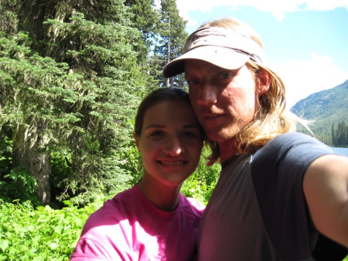
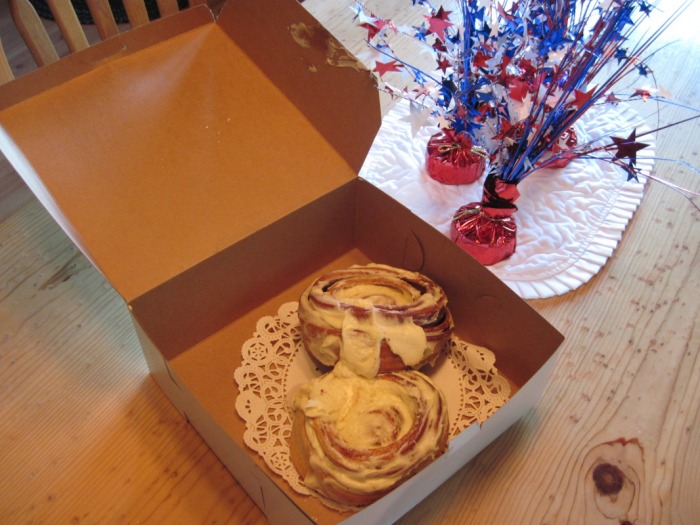
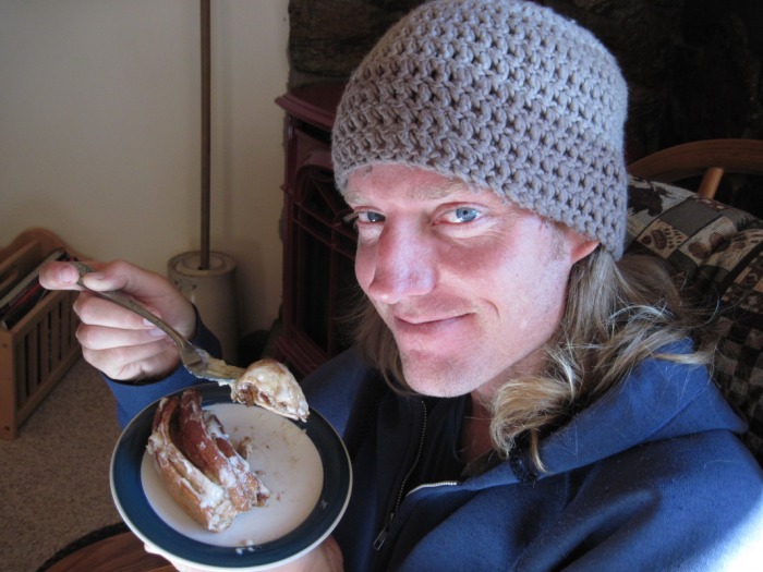
well, this was my third time in stehekin this year, i finally made it to the bakery the next morning, got 2 cinnamon roles to bring back for cassandra. i signed the register in the post office, made some connections with mark and james at the visitors center, even talked to jon the intern ranger for quite awhile outside the store before getting on the ferry. derrick in the store gave me the latest updates on the world cup and all i needed now was to see my wife.
-jason
from milk creek i headed back up into the snow where i found some footprints, but they didn't last long, only about a half mile or so and went into some trees on a steep slope, i checked the gps and continued on higher up on the slope and didn't see prints again for quite awhile, not until descending toward vista creek did i see them again. i was really hoping meet up with some other southbounders, but it wasn't meant to be. it truly was the 'hans solo' journey as i didn't see anyone until getting to high bridge for the bus to stehekin the next day. the sun tried to peak out this day, but still no views of glacier peak. quite a bit of snow traversing and then headed down toward the creek. now i knew that there was supposed to be a section of 2-3 miles just before getting to the suiattle river that was covered with old growth blow downs, although i didn't have a clue if i was going to make it to the suiattle today or not. as i went down, i had to climb over a few trees, i feel a couple of times, but in the back of my head i didn't think they were too bad at all, i knew that it was supposed to get really bad. each of the trees had a path around them and never gave me too much trouble, i just tried to keep forward momentum. vista creek had a log across it at the water level and some flagging tape where the trail continued. it was so nice to be walking on trail and not snow. the section between vista creek and the suiattle river was beautiful. a few down trees. as i made my way to the suiattle, i was pretty excited to see the 'log' across the river. we went to the ranger station the day before i left to try to find out about trail conditions, which of course no one knows about since no one has been out yet this year. the ranger said to take the detour because the log across the river was 30 feet high over the raging water and not worth the risk. when the river came into view, i was slightly disappointed, it was not raging, it actually looked like it could be forded if you had to. i found the 'log' and it was not 30 feet up, it was angled slightly and i was easily able to walk across it. my near side was at about water level and the other side was maybe 10 - 15 feet up from the water. once i was across, i made my way back to the trail and finally found the official detour signs and maps, although i'm not sure why they were where they were, but it was so nice to look at a map for awhile and it even had an elevation profile. i looked at it for quite awhile, and then continued on thinking that i would see another one where the official detour starts at the buck creek trail. the trail was amazing through this section, lots of creeks and it was sunny, although i was in the trees and couldn't see much. when i arrived at the buck creek trail junction, i looked for the official detour signs and there was nothing there, nothing mentioning a detour, nothing mentioning the old pct, nothing. i guess that nothing had been marked this year and the signs must have disappeared from last year, odd. i felt partially accomplished knowing that i had made it on the old pct route around glacier peak, wow. God had not given me any more than i could handle, i felt so humbled. i knew from the elevation profile on the other sign that i only had one more pass before the heading down the valley to high bridge and i thought that if i could make it over the pass this evening, it would make the day easier tomorrow, so i pushed on. the trail was mainly clear up to suiattle pass and i got my very first view of glacier peak off in the distance. better late than never i suppose. once getting over the pass, there was quite a bit of snow on the other side, but i was motivated. my camp for the night was on a bare spot of trail probably a mile or so down from the pass. it was a clear sky, the stars were spectacular an
i woke up to more clouds and realized that i had to backtrack to where the pct split from the trail where the footprints were. i got a little excited about having the prints in the snow and just blindly followed them probably a half mile in the wrong direction. after going back and heading up higher in the snow, i wrapped around the ridge and over another small pass (wishing i knew the names of them) i eventually started heading down in elevation and eventually got to bare trail which was really exciting. i'm going to make this one short, it was a good day, crossing new bridges, old broken bridges, seeing signs to kennedy hot springs and ones that said that they were blasting around mill creek in 08 and 09. oh wait, its coming back to me now, probably the toughest part of this section was around the mica lake area. it was pretty steep up there and i did a couple of long glissades down toward the lake, which was frozen over, but really beautiful. lots of snow, no views. i descended towards milk creek where the trail was eventually snow free and very well maintained. there was a spot where i saw a split in the trail, but nothing was labeled so i continued down creek on the well maintained trail which lead to a bridge, but when i turned on the gps, i was off of the pct by quite a ways and just hoped that the trail would lead back up to it. fortunately it did, although the trail was totally overgrown, it was raining and i was getting soaked. all i really wanted to do was find a flat spot and go to bed, but i also didn't want to leave all of this nasty wetness for tomorrow. needless to say i pushed on a little bit, found where the trail reconnected with the original which had signs posted and found a not so flat spot on the trail to struggle to set the tarp up and go to bed. the tarp fell over many times trying to put it up, i lost a stake, but i was able to stay warm and dry that night. alright, i'm giving you all kinds of details that you don't need to really know, but it was a good day, a long one, but a good one, i just wish i
this was not the greatest day in my memory. i didn't sleep very much at all, not because i was cold, but my first couple nights out are always the hardest for me, so i remember waking up all night. when it finally got light, i packed up, had some leftovers for breakfast and headed out knowing that i have hiked this section of trail and have wonderful memories of it being beautiful views and diverse landscape. unfortunately i was in snow pretty much all day and didn't recognize hardly anything. i did a lot of postholing along hillsides and some sliding down steep sections. the first place i really recognized was the descent down to pass creek from cady pass. i got down to the creek and decided that i deserved a break and was going to make lunch. i found a boulder on the other side of the creek, put my back down, reached to my back pocket to pull out the guidebook and there was no guidebook. we use erik the black's pct atlas and i keep it in a ziplock in my back pocket for easy access. i panicked and reached back two or three times hoping that it was in there, i looked all around the boulder, nothing. i left my pack there, and prayed that the guidebook was somewhere up the long descent that i had just come down. i think i was partially in shock, i couldn't believe that i had lost it, why was this happening, why me, why now? i spent an hour and a half following my foot steps hoping that i would find it laying on the snow. at one point i postholed and fell completely forward so that my pack came over my head, i was really hoping that it was there. it wasn't. i never found it. honestly, i shed some tears wondering what i was going to do now and came to the conclusion that i would just keep going trusting in the gps. so if you are out hiking around the cady pass area, keep an eye out for a washington pct atlas in a zip lock and i would love to get it back, i spent many hours turning the topos into shaded topos. so if any of you are feeling adventurous...
i figured that i just had to continue on and that God wouldn't give me more than i could handle and of course its all part of the adventure. the trail continued to not bring back any memories and i was kind of shocked when i got to lake sally ann, which is one of my favorite places. unfortunately the weather never cleared up and i didn't get to see glacier peak at all. i reached the indian pass sign around dinner time and was really hoping that there would be a map showing the detour and some of the mileage, but no. there was an old lamenated crumpled up sign that said pct detour and that was it. i pushed on through the snow heading out on the old pct, not knowing what passes where coming up or how far i had to go. i slept on a bare spot of trail near a pass where i actually saw some footprints, but never saw the people.
so many thoughts and yet how to put them down into a readable form. i will do my best to do a day by day account, but i didn't journal and will try to keep details straight.
the decision to hike without cassandra was actually her idea, but i do admit that i was getting a little restless just just sitting around. i did get my fix of watching the world cup, i pretty much watched all the replays over the week and a half that we were at home, so i guess i couldn't complain too much.
i was happy that cassandra could at least hike in part of the way as i headed out north from steven's pass on the way to stehekin. when we parted ways, it was very bitter sweet and it wasn't long before i was thinking, what am i doing out here alone? what if something happens? i tried not to think about it for too long and really spent quite a bit of time just praying and trusting that God is taking us on this journey and wouldn't let anything happen beyond His control.
i hit snow very quickly after we parted and of course that meant having the trail leave me, which it did many, many, many times over the next few days. unfortunately it was really cloudy and foggy and i didn't really have any views, although once i got north of union gap i was on actual trail for a little bit which does wonders for the motivation. it didn't last long and i hit snow again just before getting to lake janus. heading north from there i don't remember seeing much of the trail for quite awhile. (i'll do a post about the gps that i use later because if it wasn't for the gps, i would still be out there)
when you can't see much around you, its always tough to figure out exactly where you are on the map, so instead of constantly trying to figure it out, i just tried to stay on the trail and keep moving. i brought snow shoes with for this section thinking i would find some flatter sections, but i only used them once that first day and spent more time falling on my butt and sliding all over the place, so i kept them on my pack for the rest of the trip thinking about how much they weighed.
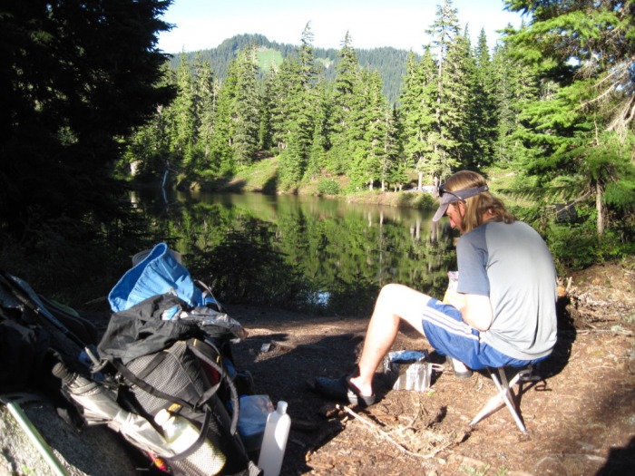
i didn't have too much trouble that first day, i used trekking poles a little bit and the ice axe for a little bit, but overall was able to keep a steady pace and made it all the way to pear lake for the night and found a bare spot at the first camp sight by the lake. it was somewhere around 18 miles, which i was pretty excited about.
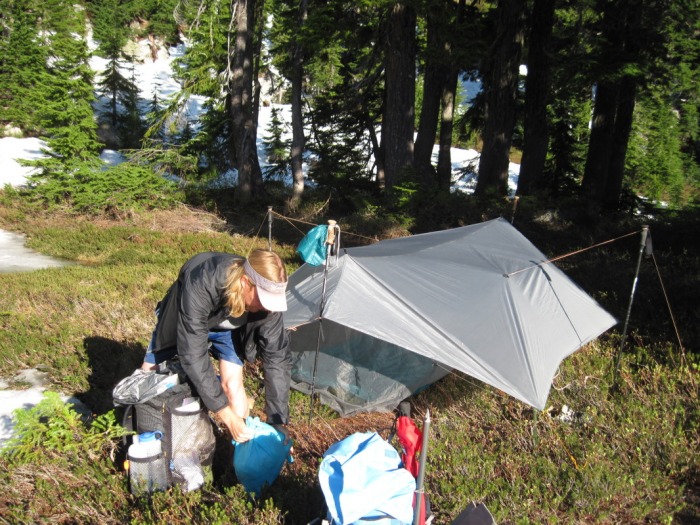
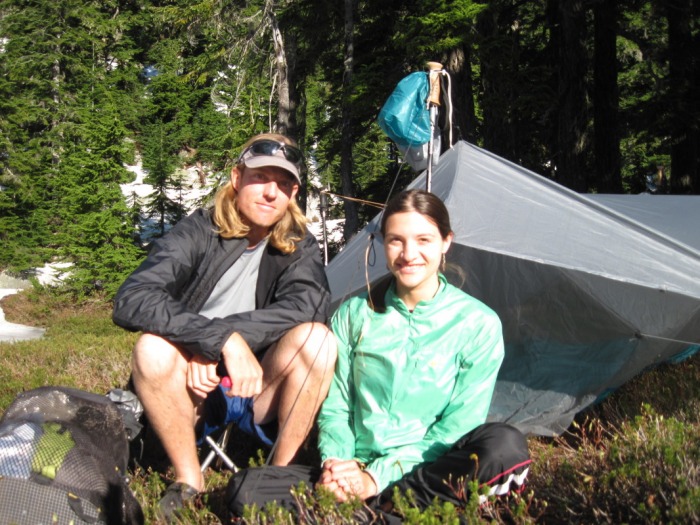
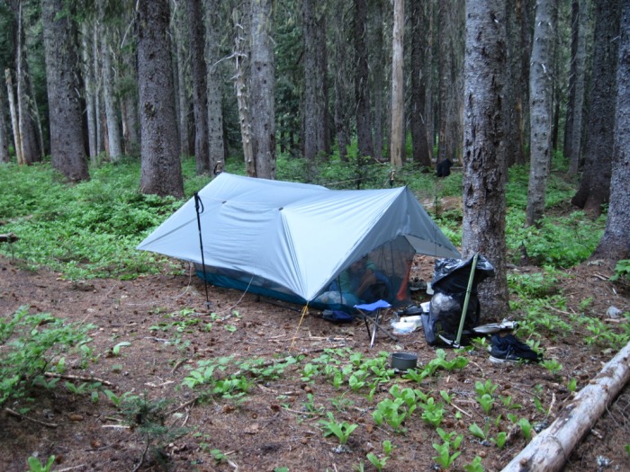
i set up the tarp and cooked dinner as it got dark and was so thankful to be at a familiar place. (i had been rained out at that site last fall on a trip with high school freshman when a lake appeared right where the group was sleeping and we had completely soaked sleeping bags, floating sleeping pads and some very cold campers, sploosh!! up to my shins is what i remember about that night.)
day one of the 'hans solo' journey complete, God is good.
-jason
|


 RSS Feed